How Murata and REKA brought traffic intelligence to Malaysia

32,000+Active vehicles counted each month in Cyberjaya
76%Fewer vehicles on the road during the MCO
3Countries with active sensing work: Malaysia, Thailand, Vietnam
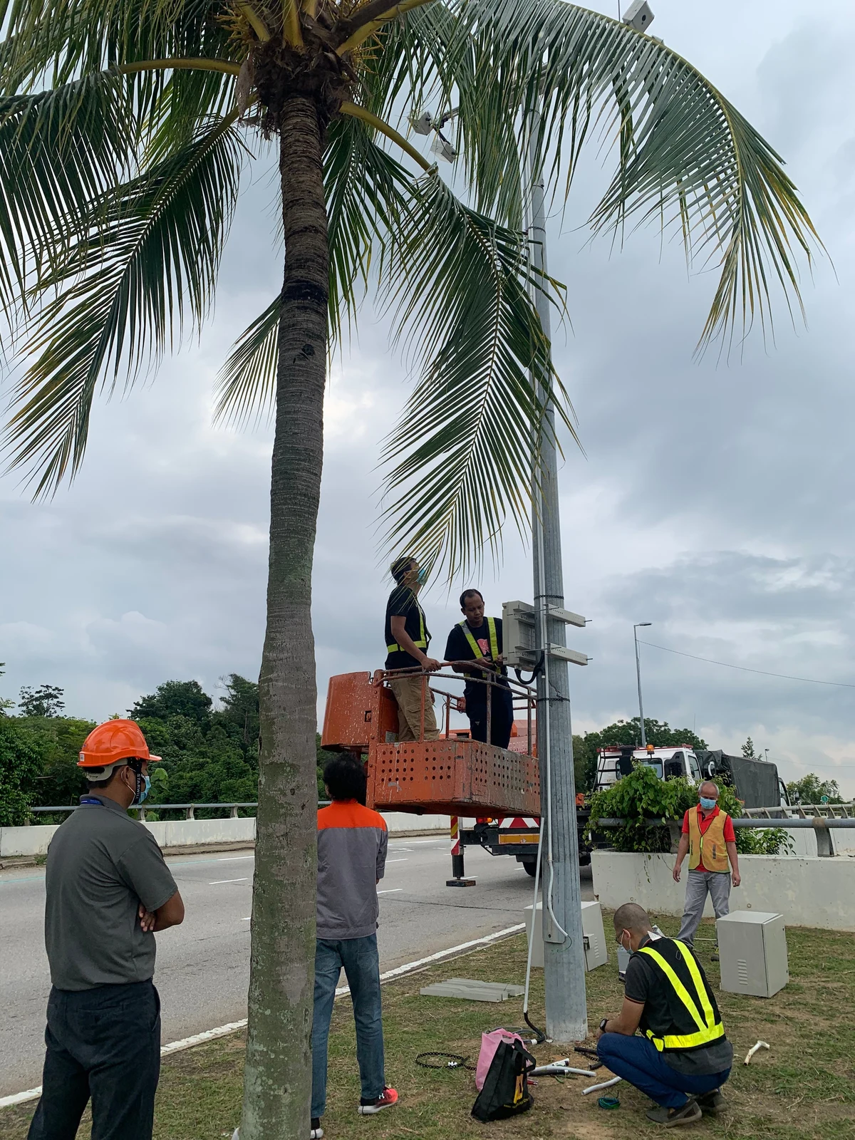
REKA archive. Murata media-kit field installation photograph. Exact location and the people’s identities are not independently verified.

“I am very excited to bring this ground-breaking work to our local ecosystem, as real-time data is the most important piece of information that agencies require today.”

Company

Murata Manufacturing Co., Ltd. is a worldwide leader in the design, manufacture and sale of ceramic-based passive electronic components and solutions, communication modules and power supply modules.

Visit Murata ↗Industry

Smart cities and traffic data

Deployed in

Cyberjaya, Malaysia

Line of workVisit PLExyz ↗

With Murata, REKA localised a traffic-counting sensing system in Malaysia and is expanding it across the region to power data-driven cities. The system takes raw data from Murata’s sensors, and REKA analyses it in real time: vehicle class, number of vehicles and CO2 emissions within each sensor’s coverage. REKA’s COO, Amri Mohd Din, announced the partnership in March 2021.

Impact summary:
  • Deployed in Cyberjaya, with the data prepared for the Sepang Municipal Council
  • Over 32,000 active vehicles counted each month, through to April 2020
  • Traffic during the MCO tracked from 1,521,041 vehicles down to 369,956
  • Counts vehicles and their speed, never the people inside them
  • Part of the smart-city sensing line recognised by Frost & Sullivan in 2022
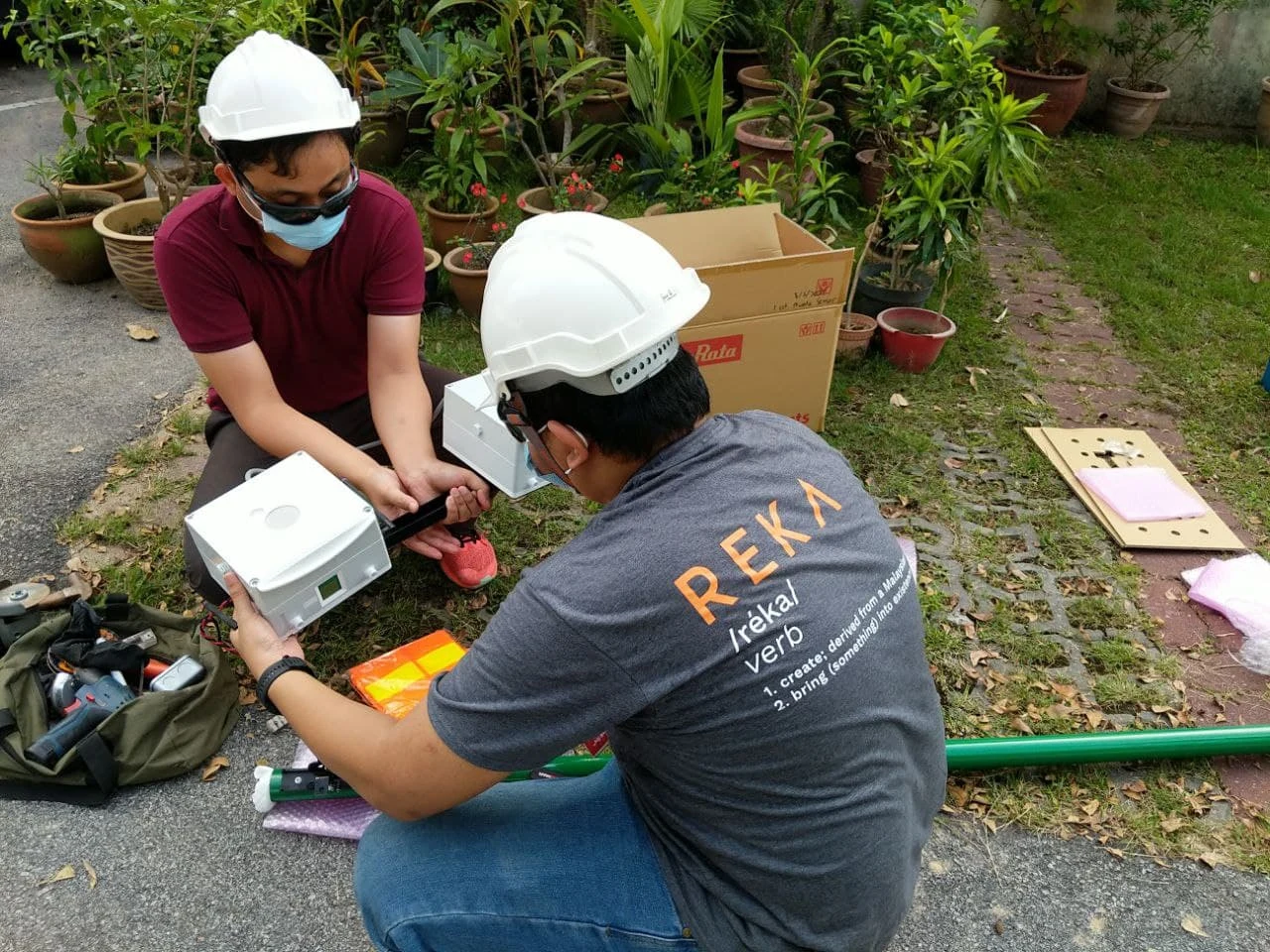
REKA archive photograph. Two people preparing sensing enclosures outdoors in the Murata media kit; no individual identities or specific location assigned.

Cities need real-time data they can trust

From sensor to council: Murata traffic sensing Murata’s traffic sensors, deployed in Cyberjaya, send raw data to REKA, which analyses it in real time: vehicle class, number of vehicles and CO₂ within each sensor’s coverage. The data is prepared for the Sepang Municipal Council and used by planners and agencies for more informed decisions. It also gives the digital advertising sector real-time traffic information. The sensor counts vehicles and their speed, never the people inside them. counts vehicles and their speed,never the people inside them MurataTraffic sensorsdeployed in Cyberjaya REKAReal-time analysisanalysed as it arrives vehicle classnumber of vehiclesCO₂ within coverage Prepared forSepang MunicipalCouncil smart-city initiatives,planning for developing areas Used byPlanners and agenciesmore informed decisions about the areas they develop Digital advertisingreal-time traffic information From sensor to council: Murata traffic sensing Murata’s traffic sensors in Cyberjaya send raw data to REKA for real-time analysis; the data is prepared for the Sepang Municipal Council and used by planners and agencies, and also serves digital advertising. It counts vehicles, never the people inside them. counts vehicles,never the peopleinside them MurataTraffic sensorsdeployed in Cyberjaya REKAReal-time analysisvehicle class · count · CO₂ Prepared forSepang MunicipalCouncil Used byPlanners and agenciesmore informed decisions Digital advertisingreal-time traffic information

ReadoutFrom sensor to council. Hover or tap a part to read what it does.

Businesses now advertise in physical space and are expected to track it as precisely as they track digital. Agencies planning smart cities need the same thing: real-time information about the roads they manage.

REKA set out to provide real-time traffic information that would benefit smart-city initiatives as well as the digital advertising sector.
AI-generated illustration. Create ONE photorealistic editorial photograph for a website photo-only mock, landscape 4:3 composition, no collage. This is an illustrative scene, NOT documentary evidence of a named client, REKA staff or deployment. Natural Malaysian tropical daylight where relevant, practical modest setting, restrained colours, no readable screens, no text overlays, no watermarks, no brand logos, no branded uniforms, no identifiable faces, no generated charts or interface. Contextual city street photograph in Kuala Lumpur-style urban Malaysia at blue hour, a large completely blank neutral billboard on a steel frame above a multi-lane road, cars and motorcycles passing below, soft distant towers but no precise identifiable junction or landmarks. No mounted sensors, no location labels. Broad realistic street context, not a claimed actual Murata sensor site. Keep billboard and traffic visible together. Fictional illustrative photograph; not a REKA/client project record.

There was a second worry. A common fear with data tracking and sensors is the public’s privacy, and any system that counted traffic had to answer it before it answered anything else.

Murata brought the sensors. REKA brought the sensors-and-edge know-how first built for its self-driving car. Together they localised the system for Malaysia.

Sensing, privately

The sensor is built to protect each person’s privacy. It does not detect any individuals inside a vehicle: it only counts vehicles and detects their speed, along with the data components around the sensor.

Each reading is classified by vehicle class, the number of vehicles and CO2 emissions within the sensor’s area of coverage.

That design is what lets a city use the data without turning its roads into a surveillance system.

Raw data into real-time analysis

The system takes raw data from Murata’s sensors, and REKA analyses it with high accuracy, in real time, to produce analysis based on the traffic counter result.

It sits on the traffic and sensing data platform that REKA and Murata are building together for the region.

“REKA understood both the sensor and the local roads, which is why the deployment worked,” said Piyamas Puangsri (ปิยะมาศ พ่วงศรี), Murata Thailand.
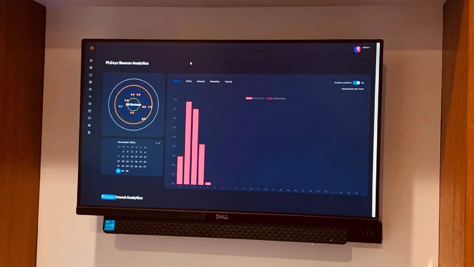
REKA archive photograph. Real archive photograph of the traffic-data platform displayed on a monitor, from murata-img-3.jpg. This is not a newly generated dashboard or a direct screen export.

Real-time information serves two kinds of user at once: agencies working on smart-city initiatives, and the digital advertising sector.

The same data can help planners and agencies make more informed decisions about the areas they are developing.

From Cyberjaya to the council
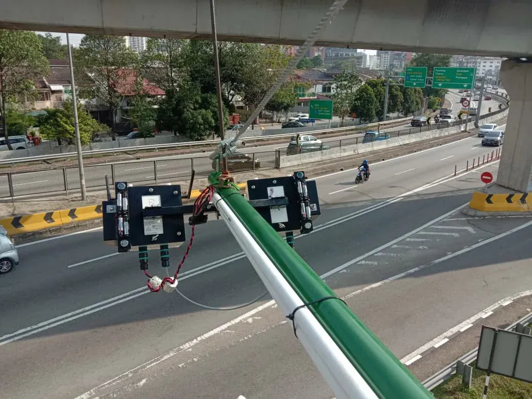
REKA archive photograph. Murata traffic sensors mounted on a roadside pole in the REKA archive. Reused for the same project story; this is a contextual photograph, not a verified map of sensor locations in Cyberjaya.

The technology was deployed in Cyberjaya, where it counted over 32,000 active vehicles a month through to April 2020. The data was prepared for the Sepang Municipal Council and turned into information that planners and agencies could act on.

During the MCO: 1,521,041 vehicles down to 369,956

Vehicles counted in Cyberjaya, before and during the MCO The sensor data counted 1,521,041 vehicles before the Movement Control Order and 369,956 during it, about 76% fewer. Before the MCO 1,521,041 76% fewer During the MCO 369,956 Vehicles counted in Cyberjaya, before and during the MCO The sensor data counted 1,521,041 vehicles before the Movement Control Order and 369,956 during it, about 76% fewer. Before the MCO1,521,041 76% fewer During the MCO369,956

ReadoutVehicles counted in Cyberjaya: 1,521,041 before the MCO, 369,956 during it.

When the pandemic arrived, local authorities could use the same data to see whether the Movement Control Order was working. The count fell from 1,521,041 vehicles to 369,956, a sign that people were staying at home.

“This collaboration between Murata and REKA is extremely important, especially in Malaysia with all the smart city initiatives that have been brought to the table, while also monitoring the effectiveness of the safety measures set in place by the government” said Amri Mohd Din, COO of REKA.

Across the region

From 2019 REKA applied the sensors and edge computing built for its car to smart-city sensing with Murata, and built out an ASEAN sensing platform.
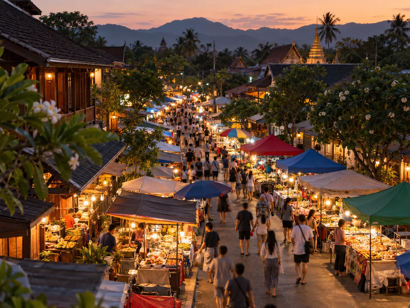
AI-generated illustration. Create ONE photorealistic editorial photograph for a website photo-only mock, landscape 4:3 composition, no collage. This is an illustrative scene, NOT documentary evidence of a named client, REKA staff or deployment. Natural Malaysian tropical daylight where relevant, practical modest setting, restrained colours, no readable screens, no text overlays, no watermarks, no brand logos, no branded uniforms, no identifiable faces, no generated charts or interface. Elevated wide photo of a Thai evening street food market with small warm-lit food stalls and a modest crowd of shoppers walking between them, authentic ordinary Thai streetscape, no readable signs, no faces in sharp focus, no sensors or cameras visible. Broad contextual crowd scene, not a named market, specific event or claimed project deployment. Fictional illustrative photograph; not a REKA/client project record.

Today the work is regional:

  • Malaysia: traffic counting localised with Murata, starting in Cyberjaya.
  • Thailand and Vietnam: crowd analytics, alongside Malaysia.
  • A regional rollout of the traffic and sensing data platform, built with Murata.
“REKA is excited to be an active link that prioritises emerging initiatives and ideas in direct contact with the data collected” Amri added.
The impact on how cities decide

What live traffic data made possible:

  1. Planners and agencies got traffic data classified by vehicle class, count and CO2 emissions.

  2. Local authorities could watch the effect of the MCO on the roads, from 1,521,041 vehicles down to 369,956.

  3. The digital advertising sector got real-time traffic information.

AI-generated illustration. Create ONE photorealistic editorial photograph for a website photo-only mock, landscape 4:3 composition, no collage. This is an illustrative scene, NOT documentary evidence of a named client, REKA staff or deployment. Natural Malaysian tropical daylight where relevant, practical modest setting, restrained colours, no readable screens, no text overlays, no watermarks, no brand logos, no branded uniforms, no identifiable faces, no generated charts or interface. Top-down still-life of a folded generic abstract road-layout paper with sparse unlabeled grey lines, one pencil, two orange paper clips and an ordinary closed notebook on a pale wood table in daylight. No readable words, no exact real city map, no charts, no screens, no people. Editorial planning materials detail, not actual council records or a fabricated Cyberjaya sensor-site map. Fictional illustrative photograph; not a REKA/client project record.

The sensing work this partnership belongs to was recognised by Frost & Sullivan for Best Crowd Analytics in 2022, and continues today as PLExyz.

The privacy rule held throughout: the system counts vehicles, never the people inside them.